LANDCARE HELPS FARMERS TO LEARN ABOUT NEW TECHNOLOGIES FOR DROUGHT FOREWARNING
Use of new technologies to help farmers make informed management decisions as drought approaches.
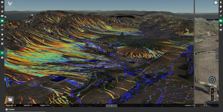
With drought patterns shifting as part of a changing climate, Hovells Creek Landcare is helping equip farmers to make informed decisions about their properties using the latest technology, including high-resolution, three-dimensional farm mapping and modelling from Australian business Agronomeye.
The maps, known as a digital twin, are created using drones, planes and satellite imagery. They enable farmers to model scenarios, including detailed water flow predictions that can support decisions around paddock use, water storage and more.
Agronomeye CEO Stu Adam says there is an incredible amount of data available to farmers, but being able to integrate it, apply it directly and specifically to their own farms, and act on it, has been difficult.
“This project will enable landholders to better manage erosion across their property, build dams that capture as much water as possible and identify opportunities to improve biodiversity and animal welfare – we are here to help farmers fundamentally improve their landscape and their business.”
Hovells Creek Landcare Group has been working with Agronomeye to complete 3D mapping of a large section of the Hovells Creek valley, as part of a larger project supported by the Australian Government’s Future Drought Fund.
Group Chair Gordon Refshauge says the broader project is about building drought resilience.
“We wanted to improve our members’ ability to predict when dry times were approaching and to be able to better manage them using a range of new technologies,” he says.
As part of the project, HCLG commissioned Cropsol Consulting Services to install two new soil moisture probes in the valley to give more localised soil moisture data and enable predictive information about pasture growth and livestock performance. Once the probes are calibrated, the data will be publicly available through the Local Land Services Farming Forecaster website.
Hovells Creek Landcare Group also ran workshops and one-on-one training for interested members on how to use CSIRO’s GrassGro software, which allows farmers to build farm plans and model different management scenarios for approaching drought, such as feeding, containment systems, agistment, selling and so on. The software also allows farmers to optimise stocking rates in good times and to do profit analysis, enterprise comparisons (such as breed, time of joining, or species) and analysis of post-drought or non-drought restocking opportunities.
“This project has allowed HCLG to take a significant step towards allowing our members to be forewarned about approaching dry times and we are very grateful to the Australian Government for their funding,” Gordon says. “We are also very grateful to South East Local Land Services for their help with probe calibration and data upload”.


